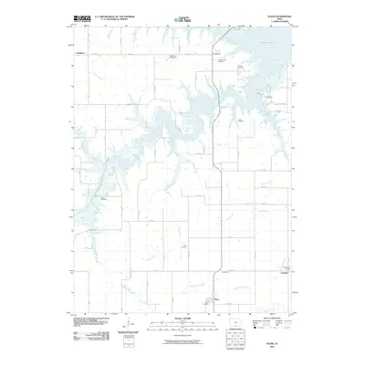
2010 Map of Plano
USGS Topo · Published 2010About this map
Rathbun Lake dominates the northern landscape of this Appanoose County region, where the flooded reaches of the South Fork Chariton River create a complex shoreline of inlets and points. The area is characterized by small, dispersed rural settlements such as Plano, Confidence, and Griffinsville, which are connected by a grid of local routes like Co RD j18 and HWY j18. The map reveals a high density of small burial grounds that suggest a long-established agricultural community, including the Wadlington Cemetery, Brushy Cemetery, and Philadelphia Cemetery near Garfield. Numerous watercourses like Sandy Branch and Little Walnut Creek drain the surrounding fields, while the Plano Post Office serves as a central landmark for the local township. This survey provides a clear view of the rural infrastructure and land use just south of the lake.
Find a feature on this map
35 named features on this map. Tap any name to fly to it.
Don’t see what you’re looking for? This feature index may not catch every label — zoom into the map to look around manually.
Map Details
Editions of this 2010 Plano Map
This is the sole edition of this map. No revisions or reprints were ever made.
Other maps of this area

1935 · Russell
USGS Topo · 1:62,500

1938 · Russell
USGS Topo · 1:62,500

1939 · Centerville
USGS Topo · 1:62,500

1939 · Mystic
USGS Topo · 1:62,500

1941 · Centerville
USGS Topo · 1:62,500

1942 · Mystic
USGS Topo · 1:62,500

1942 · Seymour
USGS Topo · 1:62,500

1944 · Seymour
USGS Topo · 1:62,500

1954 · Centerville
USGS Topo · 1:250,000

1957 · Centerville
USGS Topo · 1:250,000