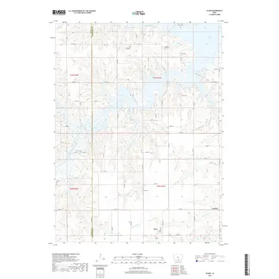
2018 Map of Plano
USGS Topo · Published 2018About this map
Plano and the smaller settlement of Garfield occupy the southern portion of this landscape, situated along the border of Wayne and Appanoose Counties. The northern half of the region is defined by the reaching fingers of Rathbun Lake, a major reservoir that has altered the drainage patterns of the South Park Chariton River and its various tributaries like Catfish Br and Southfork Pl. The terrain is characterized by dissected uplands and numerous small creek valleys, including Little Walnut Cr and Wolf Br.
Find a feature on this map
29 named features on this map. Tap any name to fly to it.
Don’t see what you’re looking for? This feature index may not catch every label — zoom into the map to look around manually.
Map Details
Editions of this 2018 Plano Map
This is the sole edition of this map. No revisions or reprints were ever made.
Other maps of this area

1935 · Russell
USGS Topo · 1:62,500

1938 · Russell
USGS Topo · 1:62,500

1939 · Centerville
USGS Topo · 1:62,500

1939 · Mystic
USGS Topo · 1:62,500

1941 · Centerville
USGS Topo · 1:62,500

1942 · Mystic
USGS Topo · 1:62,500

1942 · Seymour
USGS Topo · 1:62,500

1944 · Seymour
USGS Topo · 1:62,500

1954 · Centerville
USGS Topo · 1:250,000

1957 · Centerville
USGS Topo · 1:250,000