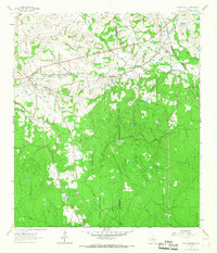
1962 Map of Plantersville
USGS Topo · Published 1967About this map
Plantersville sits at the intersection of early Texas commerce and transit along the boundary of Grimes and Montgomery Counties. By the early 1960s, this landscape was defined by its railroad infrastructure, where the Gulf Colorado and Santa Fe and the Missouri Pacific lines converge. Small settlements like Dobbin and Bobville appear as critical hubs for the local economy, while an Old Railroad Grade further south indicates the shifting patterns of transportation in the piney woods.
Find a feature on this map
29 named features on this map. Tap any name to fly to it.
Don’t see what you’re looking for? This feature index may not catch every label — zoom into the map to look around manually.
Map Details
Editions of this 1962 Plantersville Map
2 editions found
Other maps of this area

1954 · Beaumont
USGS Topo · 1:250,000

1957 · Beaumont
USGS Topo · 1:250,000

1959 · Montgomery
USGS Topo · 1:24,000

1960 · Waller NW
USGS Topo · 1:24,000

1961 · Anderson
USGS Topo · 1:24,000

1961 · Stoneham
USGS Topo · 1:24,000

1962 · Keenan
USGS Topo · 1:24,000

1962 · Dacus
USGS Topo · 1:24,000

1962 · Plantersville
USGS Topo · 1:24,000
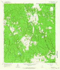
1962 · Magnolia East
USGS Topo · 1:24,000