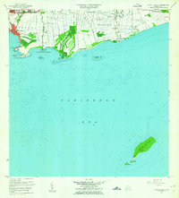
1962 Map of Playa De Ponce
USGS Topo · Published 1964About this map
Playa de Ponce serves as the industrial and maritime gateway for the region in the early 1960s, featuring the extensive Muelle de Ponce and a prominent Faro at Punta Peñoncillo. The coastal landscape is defined by the convergence of several waterways, including the Río Portugués and Río Bucaná, which flow toward the Caleta de Cabullón. Farther offshore, the distinctive Isla Caja de Muertos is mapped with precision, showing its highest point at Cerro Morrillo and the neighboring Isla Morrillito.
Find a feature on this map
48 named features on this map. Tap any name to fly to it.
Don’t see what you’re looking for? This feature index may not catch every label — zoom into the map to look around manually.
Map Details
Editions of this 1962 Playa De Ponce Map
This is the sole edition of this map. No revisions or reprints were ever made.
Other maps of this area

1944 · Santa Isabel
USGS Topo · 1:30,000

1945 · Playa De Ponce
USGS Topo · 1:30,000

1945 · Ponce
USGS Topo · 1:30,000

1945 · Rio Descalabrado
USGS Topo · 1:30,000

1946 · Punta Cuchara
USGS Topo · 1:30,000

1946 · Penuelas
USGS Topo · 1:30,000
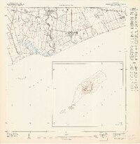
1947 · Playa De Ponce NE
USGS Topo · 1:10,000

1947 · Punta Gughara NE
USGS Topo · 1:10,000

1947 · Ponce SO
USGS Topo · 1:10,000
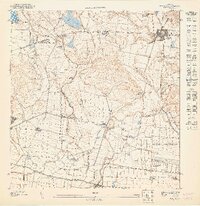
1947 · Ponce SE
USGS Topo · 1:10,000