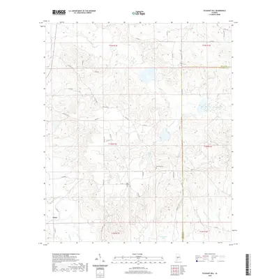
2020 Map of Pleasant Hill
USGS Topo · Published 2020About this map
Swink anchors the southwestern corner of this Dallas County landscape, where the headwaters of numerous creeks carve through the terrain. The hydrology is dominated by the winding paths of Mush Cr and Hurricane Cr, which drain the northern and central sections, while the southern reaches are defined by Cedar Cr and its tributary, Dry Cedar Cr. This map documents a quiet, rural interior at the border of Dallas and Lowndes counties, characterized by a dense network of county roads such as Dallas Co 85 and Co Rd 7 that connect isolated homesteads and family landmarks. Cultural history is anchored by sites like the Mount Lebanon Cem and Underwood Cem, which serve as physical links to the area's genealogical past near Homer Br and the small impoundment of R Cullpepper Lake.
Find a feature on this map
45 named features on this map. Tap any name to fly to it.
Don’t see what you’re looking for? This feature index may not catch every label — zoom into the map to look around manually.
Map Details
Editions of this 2020 Pleasant Hill Map
This is the sole edition of this map. No revisions or reprints were ever made.
Other maps of this area

1953 · Montgomery
USGS Topo · 1:250,000

1956 · Montgomery
USGS Topo · 1:250,000

1957 · Montgomery
USGS Topo · 1:250,000

1957 · Carlowville
USGS Topo · 1:62,500

1957 · Benton
USGS Topo · 1:62,500

1957 · Braggs
USGS Topo · 1:62,500

1958 · Selma
USGS Topo · 1:62,500

1975 · Benton SE
USGS Topo · 1:24,000

1975 · Selma SE
USGS Topo · 1:24,000

1975 · Carlowville NE
USGS Topo · 1:24,000