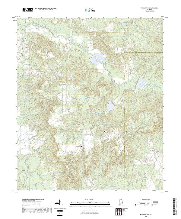
2024 Map of Pleasant Hill
USGS Topo · Published 2024About this map
Mush Creek and Hurricane Creek wind through the rolling topography of this Dallas County landscape, defining a rural region dominated by creek bottoms and a dense network of county roads. The small settlement of Swink anchors the southwestern corner of the sheet, while the presence of historic burial grounds like Underwood Cem and Mount Lebanon Cem provides valuable landmarks for those tracing local family roots. The eastern boundary of the quadrangle follows the Dallas County and Lowndes County line, a political border that bisects the drainage of Honor Branch.
Find a feature on this map
40 named features on this map. Tap any name to fly to it.
Don’t see what you’re looking for? This feature index may not catch every label — zoom into the map to look around manually.
Map Details
Editions of this 2024 Pleasant Hill Map
This is the sole edition of this map. No revisions or reprints were ever made.
Other maps of this area

1953 · Montgomery
USGS Topo · 1:250,000

1956 · Montgomery
USGS Topo · 1:250,000

1957 · Montgomery
USGS Topo · 1:250,000

1957 · Carlowville
USGS Topo · 1:62,500

1957 · Benton
USGS Topo · 1:62,500

1957 · Braggs
USGS Topo · 1:62,500

1958 · Selma
USGS Topo · 1:62,500

1975 · Benton SE
USGS Topo · 1:24,000

1975 · Selma SE
USGS Topo · 1:24,000

1975 · Carlowville NE
USGS Topo · 1:24,000