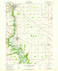
1961 Map of Pleasant Hill
USGS Topo · Published 1962About this map
The Stillwater River carves a winding path through Miami County, defining the rural character and industrial potential of the early 1960s. This survey captures several tight-knit communities along the water, from the established town of Pleasant Hill to the village of Covington in the northwest corner. The landscape is a network of section-line roads and family-named routes such as Rakestraw Road and Bausman Road, connecting isolated farmsteads to local landmarks like the Dayton Boys Club and Adams Landing Strip.
Find a feature on this map
54 named features on this map. Tap any name to fly to it.
Don’t see what you’re looking for? This feature index may not catch every label — zoom into the map to look around manually.
Map Details
Editions of this 1961 Pleasant Hill Map
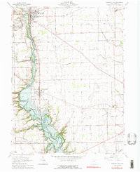
2 editions found
Other maps of this area

1904 · Dayton
USGS Topo · 1:62,500

1905 · Brookville
USGS Topo · 1:62,500

1906 · Dayton
USGS Topo · 1:62,500

1911 · Covington
USGS Topo · 1:62,500

1914 · Troy
USGS Topo · 1:62,500

1944 · Covington
USGS Topo · 1:62,500

1944 · Troy
USGS Topo · 1:62,500

1953 · Cincinnati
USGS Topo · 1:250,000

1953 · Muncie
USGS Topo · 1:250,000

1955 · West Milton
USGS Topo · 1:24,000