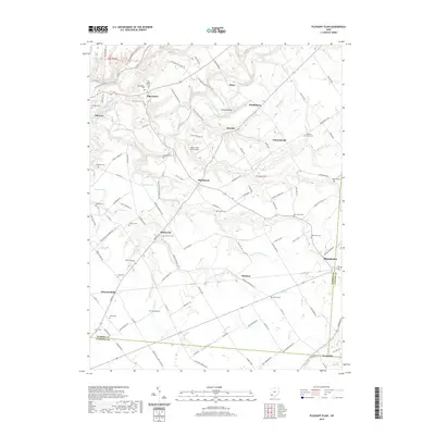
2019 Map of Pleasant Plain
USGS Topo · Published 2019About this map
Butlerville and Pleasant Plain anchor this southwestern Ohio landscape where the borders of Warren, Clermont, and Clinton counties converge. The terrain is defined by the intricate drainage of Todd Fork and Second Creek, which carve deep valleys such as Steep Hollow through the agricultural uplands. This 2019 survey reveals a high density of small rural burial grounds, including the Old Quaker Cem, Runyan Cem, and Rossella Cem, often preserved amidst modern farm holdings.
Find a feature on this map
121 named features on this map. Tap any name to fly to it.
Don’t see what you’re looking for? This feature index may not catch every label — zoom into the map to look around manually.
Map Details
Editions of this 2019 Pleasant Plain Map
This is the sole edition of this map. No revisions or reprints were ever made.
Other maps of this area

1907 · Blanchester
USGS Topo · 1:62,500

1914 · Batavia
USGS Topo · 1:48,000

1914 · Morrow
USGS Topo · 1:62,500

1916 · Batavia
USGS Topo · 1:62,500

1916 · Morrow
USGS Topo · 1:62,500

1917 · Sardinia
USGS Topo · 1:62,500

1944 · Sardinia
USGS Topo · 1:62,500

1947 · Columbus
USGS Topo · 1:250,000

1953 · Goshen
USGS Topo · 1:24,000

1953 · Newtonsville
USGS Topo · 1:24,000