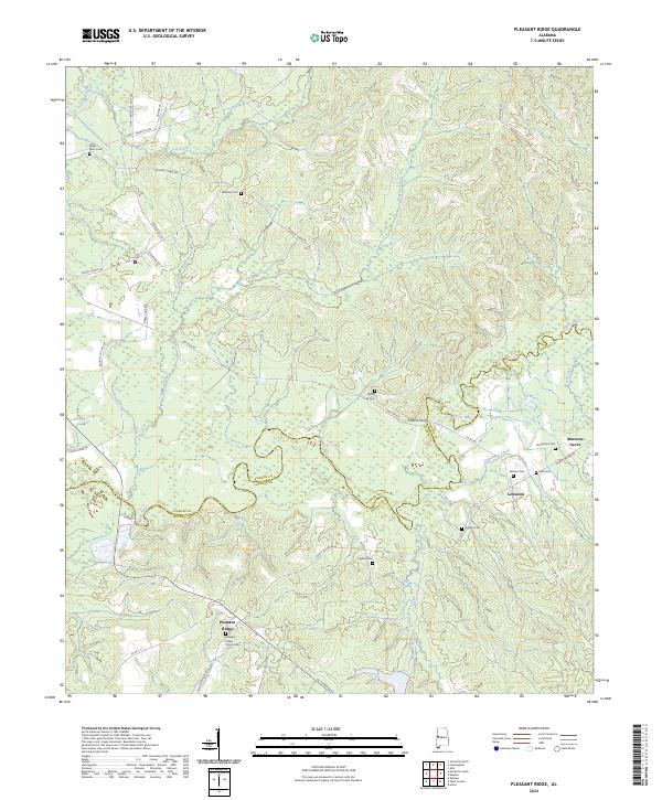
2024 Map of Pleasant Ridge
USGS Topo · Published 2024About this map
Pleasant Ridge and the Sipsey River bottomlands define this rural landscape on the border of Pickens and Greene Counties. The topography is shaped by a dense network of tributaries including Hubhub Creek, Cow Creek, and Carpenters Creek, which meander through the undulating terrain. A significant concentration of family and community burial sites such as Miller Place Cem, Shedd Hill Cem, and Sarepta Cem are scattered throughout the quadrangle, reflecting generations of settlement in this part of Alabama.
Find a feature on this map
50 named features on this map. Tap any name to fly to it.
Don’t see what you’re looking for? This feature index may not catch every label — zoom into the map to look around manually.
Map Details
Editions of this 2024 Pleasant Ridge Map
This is the sole edition of this map. No revisions or reprints were ever made.
Other maps of this area

1927 · Eutaw
USGS Topo · 1:48,000

1931 · Eutaw
USGS Topo · 1:62,500

1953 · Montgomery
USGS Topo · 1:250,000

1953 · Birmingham
USGS Topo · 1:250,000

1953 · Meridian
USGS Topo · 1:250,000

1953 · West Point
USGS Topo · 1:250,000

1956 · Birmingham
USGS Topo · 1:250,000

1956 · Montgomery
USGS Topo · 1:250,000

1957 · Birmingham
USGS Topo · 1:250,000

1957 · Meridian
USGS Topo · 1:250,000