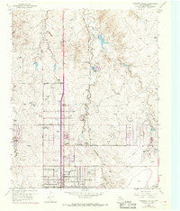
1953 Map of Pleasant Valley
USGS Topo · Published 1968About this map
East Amarillo Creek and its northern tributaries, including Rosita Creek and Indian Creek, carve through the High Plains landscape of Potter County. The map documents the northern expansion of the Amarillo City Limits during the mid-20th century, revealing a mix of public infrastructure and rural industry. Notable civic sites include the County Convalescent Home and the County Juvenile Detention Home, while leisure and media interests are represented by the Amarillo Speed Bowl and radio stations Kgnc and Kfda.
Find a feature on this map
27 named features on this map. Tap any name to fly to it.
Don’t see what you’re looking for? This feature index may not catch every label — zoom into the map to look around manually.
Map Details
Editions of this 1953 Pleasant Valley Map
Other maps of this area

1934 · Cliffside
USGS Topo · 1:62,500

1936 · Cliffside
USGS Topo · 1:62,500

1953 · Chunky
USGS Topo · 1:24,000

1953 · Puente
USGS Topo · 1:24,000

1953 · Pleasant Valley
USGS Topo · 1:24,000

1953 · Mayer
USGS Topo · 1:24,000

1953 · Cliffside
USGS Topo · 1:24,000

1953 · Berry Sand Draw
USGS Topo · 1:24,000

1954 · Amarillo
USGS Topo · 1:250,000

1956 · Amarillo East
USGS Topo · 1:24,000