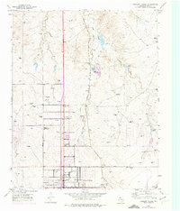
1953 Map of Pleasant Valley
USGS Topo · Published 1975About this map
The High Plains north of Amarillo come into focus through the lens of mid-century infrastructure and livestock operations. This landscape is defined by the winding course of East Amarillo Creek and Indian Creek, where numerous windmills provide the essential water for cattle ranching at the Bivins Ranch. The railroad remains a dominant force in the local economy, with the Santa Fe and Atchison Topeka and Santa Fe lines running north-south through the center of the quadrangle.
Find a feature on this map
31 named features on this map. Tap any name to fly to it.
Don’t see what you’re looking for? This feature index may not catch every label — zoom into the map to look around manually.
Map Details
Editions of this 1953 Pleasant Valley Map
Other maps of this area

1934 · Cliffside
USGS Topo · 1:62,500

1936 · Cliffside
USGS Topo · 1:62,500

1953 · Chunky
USGS Topo · 1:24,000

1953 · Puente
USGS Topo · 1:24,000

1953 · Pleasant Valley
USGS Topo · 1:24,000

1953 · Mayer
USGS Topo · 1:24,000

1953 · Cliffside
USGS Topo · 1:24,000

1953 · Berry Sand Draw
USGS Topo · 1:24,000

1954 · Amarillo
USGS Topo · 1:250,000

1956 · Amarillo East
USGS Topo · 1:24,000