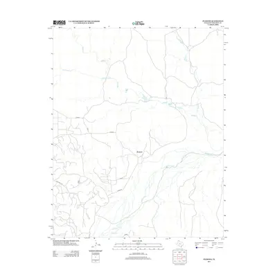
2013 Map of Plemons
USGS Topo · Published 2013About this map
Plemons sits at the heart of this Hutchinson County landscape, positioned near the braided channels of the Canadian River. This 2013 survey illustrates a region defined by its hydrology and energy infrastructure, where numerous seasonal waterways like Bugby Cr, Smokehouse Cr, and Moore Cr drain toward the primary river valley. The industrial character of the Texas Panhandle is evident in the presence of the Dial Oil Field, which occupies a significant portion of the southwestern quadrant. Local transportation is managed through a network of county routes, including Co Road Q and Plemons Rd, which connect the scattered homesteads and industrial sites to larger thoroughfares like Ranch Road 2277. The map captures the intersection of traditional cattle-country geography with the modern petroleum economy, showing how modern development follows the established paths carved by drainage basins like Dixon Cr and Carson Cr.
Find a feature on this map
14 named features on this map. Tap any name to fly to it.
Don’t see what you’re looking for? This feature index may not catch every label — zoom into the map to look around manually.
Map Details
Editions of this 2013 Plemons Map
This is the sole edition of this map. No revisions or reprints were ever made.
Other maps of this area

1953 · Plemons
USGS Topo · 1:24,000

1953 · Stinnett
USGS Topo · 1:24,000

1953 · Stinnett Station
USGS Topo · 1:24,000

1953 · Pringle
USGS Topo · 1:24,000

1953 · Phillips
USGS Topo · 1:24,000

1953 · Borger
USGS Topo · 1:24,000

1954 · Amarillo
USGS Topo · 1:250,000

1958 · Amarillo
USGS Topo · 1:250,000

1970 · Borger
USGS Topo · 1:24,000

1970 · Phillips
USGS Topo · 1:24,000