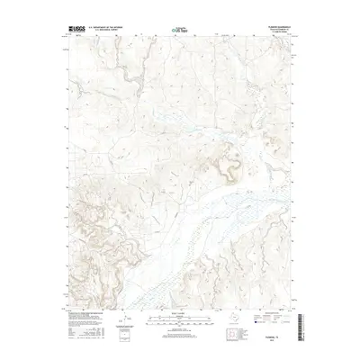
2016 Map of Plemons
USGS Topo · Published 2016About this map
The Canadian River cuts a wide, braided path through the heart of the Texas Panhandle in this modern survey of Hutchinson County. This specific landscape is defined by the complex drainage systems of several significant tributaries, including Bugby Cr, Smokehouse Cr, and Moore Cr, which carve through the high plains to meet the river. The presence of the Plemons Cem serves as a critical geographic marker for genealogists, located near the intersection of Plemons Rd and Co RD 16. The terrain is navigated by a network of county roads and Ranch Rd 2277, reflecting the ranching and energy-producing character of the region. Local watercourses such as Dixon Cr and Carson Creek further illustrate the intricate hydrology that has shaped land use and property boundaries in this part of Texas since the early days of settlement.
Find a feature on this map
13 named features on this map. Tap any name to fly to it.
Don’t see what you’re looking for? This feature index may not catch every label — zoom into the map to look around manually.
Map Details
Editions of this 2016 Plemons Map
This is the sole edition of this map. No revisions or reprints were ever made.
Other maps of this area

1953 · Plemons
USGS Topo · 1:24,000

1953 · Stinnett
USGS Topo · 1:24,000

1953 · Stinnett Station
USGS Topo · 1:24,000

1953 · Pringle
USGS Topo · 1:24,000

1953 · Phillips
USGS Topo · 1:24,000

1953 · Borger
USGS Topo · 1:24,000

1954 · Amarillo
USGS Topo · 1:250,000

1958 · Amarillo
USGS Topo · 1:250,000

1970 · Borger
USGS Topo · 1:24,000

1970 · Phillips
USGS Topo · 1:24,000