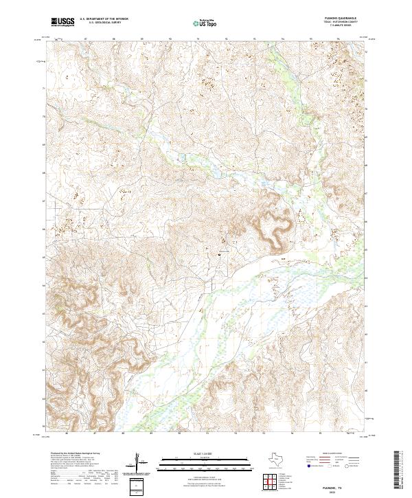
2022 Map of Plemons
USGS Topo · Published 2022About this map
Plemons Cem stands as a focal point for genealogical interest in this pocket of the Texas Panhandle, situated on the high ground north of the wide Canadian River valley. This 2022 survey documents a landscape defined by the deep incision of watercourses into the plains, with Smokehouse Creek, Bugby Cr, and Dixon Cr feeding into the braided river system. The infrastructure of the region is primarily composed of ranching and rural roads, including Plemons Rd and Ranch Rd 2277, which navigate the complex drainage basins of Moore Cr and Bear Creek. The map illustrates the contemporary management of these lands, where the natural hydrology of the breaks remains the primary geographic influence on local transit and settlement patterns.
Find a feature on this map
15 named features on this map. Tap any name to fly to it.
Don’t see what you’re looking for? This feature index may not catch every label — zoom into the map to look around manually.
Map Details
Editions of this 2022 Plemons Map
This is the sole edition of this map. No revisions or reprints were ever made.
Other maps of this area

1953 · Plemons
USGS Topo · 1:24,000

1953 · Stinnett
USGS Topo · 1:24,000

1953 · Stinnett Station
USGS Topo · 1:24,000

1953 · Pringle
USGS Topo · 1:24,000

1953 · Phillips
USGS Topo · 1:24,000

1953 · Borger
USGS Topo · 1:24,000

1954 · Amarillo
USGS Topo · 1:250,000

1958 · Amarillo
USGS Topo · 1:250,000

1970 · Borger
USGS Topo · 1:24,000

1970 · Phillips
USGS Topo · 1:24,000