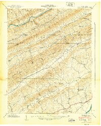
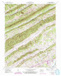
1939 Map of Plum Grove
USGS Topo · Published 1939About this map
Robinette Valley and Stanley Valley define the rhythmic topography of the Tennessee-Virginia borderlands in this 1939 survey. The landscape is characterized by a dense network of mountain ridges and narrow fertile valleys, where the Clinch River snakes along the northern edge and the Holston River touches the southeast corner near New Canton. This era reveals a deeply rooted rural infrastructure of one-room schoolhouses and community churches, such as Vale Summit Sch and Amis Chapel, which served the isolated farming settlements between Poor Valley Mountain and Copper Ridge. Transportation during this period relied on the Southern railroad line and the Lee Highway, which provided critical connections through Plum Grove Gap. Notable landmarks like Chalybeate Springs suggest the local importance of natural mineral waters in the early 20th-century Appalachian economy.
Find a feature on this map
71 named features on this map. Tap any name to fly to it.
Don’t see what you’re looking for? This feature index may not catch every label — zoom into the map to look around manually.
Map Details
Editions of this 1939 Plum Grove Map
5 editions found
Other maps of this area

1892 · Greeneville
USGS Topo · 1:125,000

1894 · Estillville
USGS Topo · 1:125,000

1896 · Greeneville
USGS Topo · 1:125,000

1904 · Greeneville
USGS Topo · 1:125,000

1935 · Surgoinsville
USGS Topo · 1:48,000

1935 · Lovelace
USGS Topo · 1:24,000

1935 · Moggasin
USGS Topo · 1:48,000

1935 · Looneys Gap
USGS Topo · 1:24,000

1935 · Clinchport
USGS Topo · 1:24,000
1935 · Duffield
USGS Topo · 1:24,000