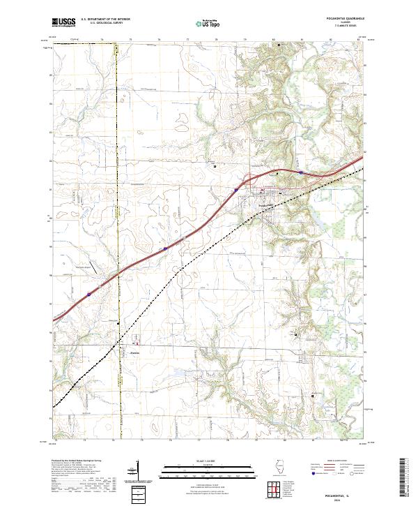
2024 Map of Pocahontas
USGS Topo · Published 2024About this map
Pocahontas serves as the central hub of this Illinois landscape, where the local road network converges near the Madison and Bond County line. The settlement pattern reflects a deeply rooted community, marked by a high density of rural burial grounds such as Saint Nicholas Cem, Sugg Cem, and Robinson Cem that speak to generations of local families. The terrain is defined by the winding course of Shoal Creek to the northeast and Sugar Creek to the southwest, which dictate the placement of local routes like Thole Plocher Rd and Jamestown Rd.
Find a feature on this map
66 named features on this map. Tap any name to fly to it.
Don’t see what you’re looking for? This feature index may not catch every label — zoom into the map to look around manually.
Map Details
Editions of this 2024 Pocahontas Map
This is the sole edition of this map. No revisions or reprints were ever made.
Other maps of this area

1906 · Breese
USGS Topo · 1:62,500

1907 · Breese
USGS Topo · 1:62,500

1910 · Carlyle
USGS Topo · 1:62,500

1932 · Greenville
USGS Topo · 1:62,500

1937 · New Douglas
USGS Topo · 1:48,000

1939 · Greenville
USGS Topo · 1:62,500

1943 · Greenville
USGS Topo · 1:62,500

1944 · New Douglas
USGS Topo · 1:62,500

1948 · Carlyle
USGS Topo · 1:62,500
1957 · Highland
USGS Topo · 1:24,000