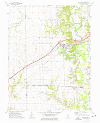
1974 Map of Pocahontas
USGS Topo · Published 1977About this map
The Penn Central Railroad corridor anchors this 1970s view of the borderlands between Madison and Bond counties. Central to the map is Pocahontas, a village defined by its grid north of the tracks and its proximity to the Stubblefield Gas Storage Field. This area reflects a landscape where traditional agriculture met mid-century energy production, evidenced by the presence of the Old Ripley Oil Field near the northern border. To the south, the settlement of Pierron sits astride the county line, with the historical Pierron (Baden Baden) designation noted further east near the banks of Shoal Creek.
Find a feature on this map
26 named features on this map. Tap any name to fly to it.
Don’t see what you’re looking for? This feature index may not catch every label — zoom into the map to look around manually.
Map Details
Editions of this 1974 Pocahontas Map
This is the sole edition of this map. No revisions or reprints were ever made.
Other maps of this area

1906 · Breese
USGS Topo · 1:62,500

1907 · Breese
USGS Topo · 1:62,500

1910 · Carlyle
USGS Topo · 1:62,500

1932 · Greenville
USGS Topo · 1:62,500

1937 · New Douglas
USGS Topo · 1:48,000

1939 · Greenville
USGS Topo · 1:62,500

1943 · Greenville
USGS Topo · 1:62,500

1944 · New Douglas
USGS Topo · 1:62,500

1948 · Carlyle
USGS Topo · 1:62,500
1957 · Highland
USGS Topo · 1:24,000