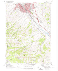
1971 Map of Pocatello South
USGS Topo · Published 1974About this map
Idaho State University anchors the eastern side of the city in this early 1970s survey, where the urban grid of Pocatello meets the rising slopes of the Pocatello Range. The city's mid-century expansion is evident in the residential clusters around Hyland Park and Bonneville Park, while the industrial and transit corridor is defined by the Union Pacific rail lines running parallel to the Portneuf River. South of the city, the landscape shifts abruptly into the protected lands of the Caribou National Forest.
Find a feature on this map
74 named features on this map. Tap any name to fly to it.
Don’t see what you’re looking for? This feature index may not catch every label — zoom into the map to look around manually.
Map Details
Editions of this 1971 Pocatello South Map
3 editions found
Other maps of this area

1934 · Michaud
USGS Topo · 1:62,500

1937 · Pocatello
USGS Topo · 1:48,000

1937 · Michaud
USGS Topo · 1:62,500

1938 · Pauline
USGS Topo · 1:48,000

1944 · Pocatello
USGS Topo · 1:62,500

1944 · Arbon
USGS Topo · 1:62,500

1954 · Pocatello
USGS Topo · 1:250,000

1958 · Pocatello
USGS Topo · 1:250,000

1968 · Clifton Creek
USGS Topo · 1:24,000
1968 · Scout Mtn
USGS Topo · 1:24,000