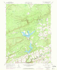
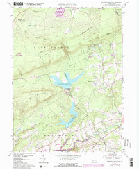
1960 Map of Pohopco Mountain
USGS Topo · Published 1972About this map
Pohopoco Mountain and Stony Ridge dominate the landscape of the Pocono region, serving as the backdrop for a massive municipal water infrastructure. The Bethlehem Municipal Water Authority manages a large reservation containing the Penn Forest Reservoir and Wild Creek Reservoir. These man-made bodies of water altered the local drainage, capturing flows from Wild Creek and Dotters Creek.
Find a feature on this map
47 named features on this map. Tap any name to fly to it.
Don’t see what you’re looking for? This feature index may not catch every label — zoom into the map to look around manually.
Map Details
Editions of this 1960 Pohopco Mountain Map
5 editions found
Other maps of this area

1914 · Wind Gap
USGS Topo · 1:62,500

1916 · Wind Gap
USGS Topo · 1:62,500

1919 · Pocono
USGS Topo · 1:62,500

1921 · Pocono
USGS Topo · 1:62,500

1922 · Mauch Chunk
USGS Topo · 1:62,500

1922 · Stoddartsville
USGS Topo · 1:62,500

1923 · Pocono
USGS Topo · 1:62,500

1924 · Stoddartsville
USGS Topo · 1:62,500

1924 · Mauch Chunk
USGS Topo · 1:62,500

1943 · Scranton
USGS Topo · 1:125,000
Featured Places
- Towamensing Township, PA
- Eldred Township, PA
- Penn Forest Township, PA
- Tunkhannock Township, PA
- Indian Mountain Lake, PA