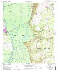
1953 Map of Poinsett State Park
USGS Topo · Published 1983About this map
The Wateree Swamp dominates this landscape along the border of Richland and Sumter counties, where the Wateree River carves a winding path through a dense network of secondary waterways like Beech Creek and Halfway Creek. The topography transitions sharply from the low-lying wetlands of the west to the higher elevations of the Manchester State Forest and Poinsett State Park in the east. This eastern upland contains several family-named landmarks and rural gathering places, including the Melrose Historical Home and Bloom Hill Cemetery.
Find a feature on this map
51 named features on this map. Tap any name to fly to it.
Don’t see what you’re looking for? This feature index may not catch every label — zoom into the map to look around manually.
Map Details
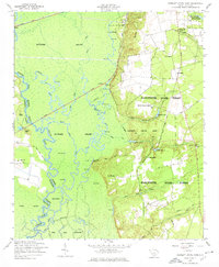
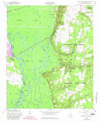
Editions of this 1953 Poinsett State Park Map
4 editions found
Other maps of this area

1943 · Eastover
USGS Topo · 1:62,500

1946 · Elloree
USGS Topo · 1:62,500

1946 · Sumter
USGS Topo · 1:62,500

1953 · Poinsett State Park
USGS Topo · 1:24,000

1953 · Eastover
USGS Topo · 1:24,000

1953 · Wedgefield
USGS Topo · 1:24,000

1953 · Wateree
USGS Topo · 1:24,000

1954 · Augusta
USGS Topo · 1:250,000

1957 · Sumter West
USGS Topo · 1:24,000

1957 · Sumter
USGS Topo · 1:62,500