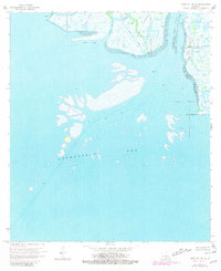
1970 Map of Point Au Fer NE
USGS Topo · Published 1981About this map
Lower Atchafalaya River water traffic and industrial activity define this coastal Louisiana landscape as it appeared in the 1970s. The map captures a shifting environment where the river meets the Atchafalaya Bay, revealing the complex network of natural and man-made waterways essential to the region's economy. Numerous Canal and Pipeline cuts, such as the P L Canal, crisscross the marshy islands, illustrating the intensity of energy exploration in the Mississippi Delta.
Find a feature on this map
16 named features on this map. Tap any name to fly to it.
Don’t see what you’re looking for? This feature index may not catch every label — zoom into the map to look around manually.
Map Details
Editions of this 1970 Point Au Fer NE Map
3 editions found
Other maps of this area

1932 · Lake Decade
USGS Topo · 1:62,500

1935 · Belle Isle
USGS Topo · 1:31,680

1935 · Morgan City
USGS Topo · 1:62,500

1941 · Belle Isle
USGS Topo · 1:62,500

1945 · New Orleans
USGS Topo · 1:250,000

1954 · Morgan City
USGS Topo · 1:62,500

1954 · Belle Isle
USGS Topo · 1:62,500

1957 · Lake Decade
USGS Topo · 1:62,500

1957 · Point Au Fer
USGS Topo · 1:62,500

1963 · New Orleans
USGS Topo · 1:250,000