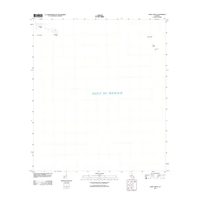
2012 Map of Point Chicot
USGS Topo · Published 2012About this map
Gulf of Mexico waters dominate this coastal landscape in Saint Bernard Parish, where only a few isolated landforms remain visible. Along the northwestern edge of the sheet, Deadman Island and its adjacent Deadman Point sit near Grass Island, marking the fragile boundary between open water and the Louisiana marshlands. On the opposite side of the map, the lonely Point Chicot Light serves as a navigational marker for the waters surrounding Chicot Island and the landform at Point Chicot. This survey reflects the extreme vulnerability of this coastal environment, where low-lying islands are the primary landmarks for mariners and local fishermen navigating the outer reaches of the parish.
Find a feature on this map
7 named features on this map. Tap any name to fly to it.
Don’t see what you’re looking for? This feature index may not catch every label — zoom into the map to look around manually.
Map Details
Editions of this 2012 Point Chicot Map
This is the sole edition of this map. No revisions or reprints were ever made.
Other maps of this area

1893 · La Fortuna
USGS Topo · 1:62,500

1893 · Chandeleur
USGS Topo · 1:62,500

1895 · Bodreau
USGS Topo · 1:62,500

1935 · Morgan Harbor
USGS Topo · 1:31,680

1935 · Lake Athanasio
USGS Topo · 1:31,680
1947 · Lake Athanasio
USGS Topo · 1:31,680
1947 · Lake Eloi
USGS Topo · 1:31,680
1954 · Morgan Harbor
USGS Topo · 1:31,680
1954 · Lake Eloi
USGS Topo · 1:31,680
1955 · Morgan Harbor
USGS Topo · 1:24,000