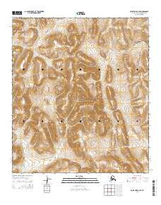
2014 Map of Point Hope C-2 SE
USGS Topo · Published 2014About this map
Mount Nasak stands as the central high point in this remote Arctic landscape within the Lisburne Hills. The terrain is defined by a network of drainage systems that carve through the high ground, notably Kugirarok Cr which winds through the southern and western portions of the quadrangle. Other significant watercourses include Uyakturok Cr in the east and Tungnak Cr in the northwest. The absence of roads or permanent structures reflects the wilderness character of the Alaska North Slope, where the topography itself dictates the movement of water and any seasonal travel across the tundra. This survey provides a precise record of the elevation contours and natural drainage patterns that have shaped this sub-arctic environment for centuries.
Find a feature on this map
11 named features on this map. Tap any name to fly to it.
Don’t see what you’re looking for? This feature index may not catch every label — zoom into the map to look around manually.
Map Details
Editions of this 2014 Point Hope C-2 SE Map
This is the sole edition of this map. No revisions or reprints were ever made.
Other maps of this area

1952 · Point Hope
USGS Topo · 1:250,000

1955 · Point Hope
USGS Topo · 1:250,000

1955 · Point Hope C-1
USGS Topo · 1:63,360

1955 · Point Hope B-1
USGS Topo · 1:63,360

1955 · Point Hope C-2
USGS Topo · 1:63,360

1955 · Point Hope B-2
USGS Topo · 1:63,360

1965 · Point Hope
USGS Topo · 1:250,000
2014 · Point Hope C-1 NW
USGS Topo · 1:25,000
2014 · Point Hope B-2 NW
USGS Topo · 1:25,000
2014 · Point Hope C-1 SW
USGS Topo · 1:25,000