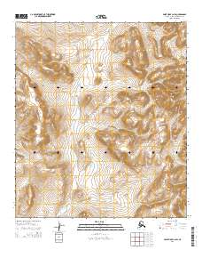
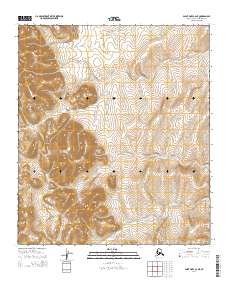
2014 Map of Point Hope C-2 SW
USGS Topo · Published 2014About this map
Akalolik Cr and its tributaries carve through the drainage basins of the North Slope, defining the hydrological character of this Arctic landscape. The map shows a terrain of sharp topographic relief, punctuated by the distinctive landmark known as The Ears, which rises between the drainage of Sigrikpak Cr to the northwest and Siniktoneyak Cr to the southwest. The grid of the Public Land Survey System, including townships t10s r61w and t10s r60w, provides the only human-imposed structure over this expansive natural environment. This 2014 survey captures the untouched state of the region's watersheds before any significant modern industrial or infrastructure development altered the natural flow of these northern creeks.
Find a feature on this map
10 named features on this map. Tap any name to fly to it.
Don’t see what you’re looking for? This feature index may not catch every label — zoom into the map to look around manually.
Map Details
Editions of this 2014 Point Hope C-2 SW Map
This is the sole edition of this map. No revisions or reprints were ever made.
Other maps of this area

1952 · Point Hope
USGS Topo · 1:250,000

1952 · Point Hope B-3
USGS Topo · 1:63,360
1952 · Point Hope C-3
USGS Topo · 1:63,360

1955 · Point Hope
USGS Topo · 1:250,000

1955 · Point Hope C-2
USGS Topo · 1:63,360

1955 · Point Hope B-2
USGS Topo · 1:63,360

1965 · Point Hope
USGS Topo · 1:250,000
2014 · Point Hope C-3 NE
USGS Topo · 1:25,000
2014 · Point Hope B-2 NW
USGS Topo · 1:25,000
2014 · Point Hope C-2 NE
USGS Topo · 1:25,000