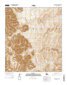
2014 Map of Point Hope C-2 NE
USGS Topo · Published 2014About this map
Mount Itsalik rises as the central landform of this remote arctic landscape in the northern foothills of the Brooks Range. The terrain is defined by complex contour elevations and the winding paths of glacial-fed drainages, specifically Oligavik Cr and Tungnak Cr. This survey illustrates the Public Land Survey System (PLSS) divisions within the North Slope, detailing the township and range boundaries of t8s r59w, t8s r58w, t9s r60w, and t9s r59w. The map provides a precise record of the hydrologic patterns and topographic relief in a region where few permanent settlements exist, making it a critical reference for understanding the physical geography and administrative grid of Alaska's high arctic interior.
Find a feature on this map
7 named features on this map. Tap any name to fly to it.
Don’t see what you’re looking for? This feature index may not catch every label — zoom into the map to look around manually.
Map Details
Editions of this 2014 Point Hope C-2 NE Map
This is the sole edition of this map. No revisions or reprints were ever made.
Other maps of this area

1952 · Point Hope
USGS Topo · 1:250,000

1952 · Point Hope D-1
USGS Topo · 1:63,360

1952 · Point Hope D-2
USGS Topo · 1:63,360

1955 · Point Hope
USGS Topo · 1:250,000

1955 · Point Hope C-1
USGS Topo · 1:63,360

1955 · Point Hope C-2
USGS Topo · 1:63,360

1965 · Point Hope
USGS Topo · 1:250,000
2014 · Point Hope C-1 NW
USGS Topo · 1:25,000
2014 · Point Hope C-1 SW
USGS Topo · 1:25,000
2014 · Point Hope D-2 SW
USGS Topo · 1:25,000