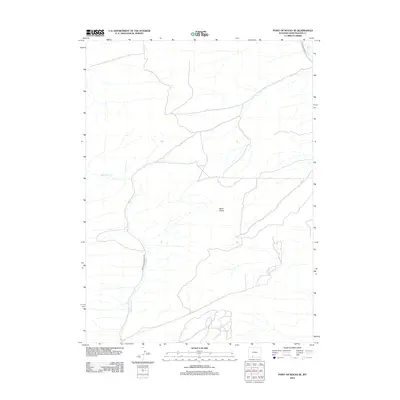
2012 Map of Point of Rocks SE
USGS Topo · Published 2012About this map
Black Buttes dominate the high desert terrain of this Sweetwater County landscape, where deep drainage patterns and dry washes define the topography. The 2012 survey by the U. S. Geological Survey details a sparsely settled region of Wyoming shaped by cattle ranching and transportation corridors. Water remains the primary architect of the land, visible through the meandering path of Black Butte Cr and the more significant Bitter Cr in the northern reach. Transportation is limited to functional routes such as Black Buttes Rd and Black Buttes Ranch Rd, which provide access across the high plains. This map captures the intersection of high-plateau geography and the practical infrastructure required for land management in the American West.
Find a feature on this map
5 named features on this map. Tap any name to fly to it.
Don’t see what you’re looking for? This feature index may not catch every label — zoom into the map to look around manually.
Map Details
Editions of this 2012 Point of Rocks SE Map
This is the sole edition of this map. No revisions or reprints were ever made.
Other maps of this area

1954 · Rock Springs
USGS Topo · 1:250,000

1958 · Rock Springs
USGS Topo · 1:250,000

1962 · Rock Springs
USGS Topo · 1:250,000

1968 · Cooper Ridge NE
USGS Topo · 1:24,000

1968 · Bitter Creek NW
USGS Topo · 1:24,000

1968 · Point Of Rocks SW
USGS Topo · 1:24,000

1968 · Sand Butte Rim NW
USGS Topo · 1:24,000

1968 · Black Buttes
USGS Topo · 1:24,000

1968 · Point Of Rocks
USGS Topo · 1:24,000

1968 · Camel Rock
USGS Topo · 1:24,000