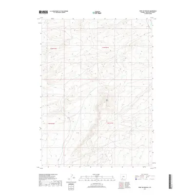
2017 Map of Point of Rocks SE
USGS Topo · Published 2017About this map
Black Buttes rise as the central landmark in this high-desert region of Wyoming, defining a landscape marked by stark elevation changes and seasonal watercourses. The drainage of Black Butte Creek cuts through the western portion of the quadrangle, eventually meeting the corridor of Bitter Creek to the northeast. This area of Sweetwater County is primarily defined by its remote infrastructure, with Co Rd 72 and Co Rd 84 providing the primary access through the townships. The map illustrates the sparse, open character of the Wyoming basin, where the land is partitioned into large blocks including t19n r101w and t18n r102w. The topographical detail reveals the complex network of draws and ridges that surround the prominent butte formations, offering a clear view of the natural terrain before any intensive modern development.
Find a feature on this map
10 named features on this map. Tap any name to fly to it.
Don’t see what you’re looking for? This feature index may not catch every label — zoom into the map to look around manually.
Map Details
Editions of this 2017 Point of Rocks SE Map
This is the sole edition of this map. No revisions or reprints were ever made.
Other maps of this area

1954 · Rock Springs
USGS Topo · 1:250,000

1958 · Rock Springs
USGS Topo · 1:250,000

1962 · Rock Springs
USGS Topo · 1:250,000

1968 · Cooper Ridge NE
USGS Topo · 1:24,000

1968 · Bitter Creek NW
USGS Topo · 1:24,000

1968 · Point Of Rocks SW
USGS Topo · 1:24,000

1968 · Sand Butte Rim NW
USGS Topo · 1:24,000

1968 · Black Buttes
USGS Topo · 1:24,000

1968 · Point Of Rocks
USGS Topo · 1:24,000

1968 · Camel Rock
USGS Topo · 1:24,000