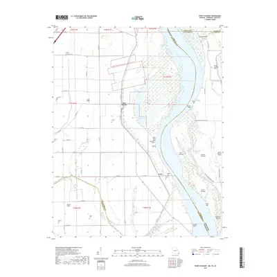
2017 Map of Point Pleasant
USGS Topo · Published 2017About this map
Point Pleasant and the riverside community of Linda anchor this study of the shifting Mississippi River landscape where Missouri, Kentucky, and Tennessee converge. The terrain is defined by the river's historical meanders and the complex network of towheads and chutes that follow its course, including Toneys Towhead and the narrow Pecan Chute. The presence of numerous family-named burial sites, such as Le Sieur Cem, Creviosur Cem, and Riddles Cem, provides a significant record of the early families who settled this fertile floodplain. Inland, the map reveals the agricultural character of the region, marked by drainage features like Portage Open Bay and the elevated ground of Barnes Ridge and Scrub Ridge. The proximity to the river is further evidenced by infrastructure like Tiptonville Ferry Rd, which historically connected these bottomland communities across the state lines of New Madrid and Lake counties.
Find a feature on this map
73 named features on this map. Tap any name to fly to it.
Don’t see what you’re looking for? This feature index may not catch every label — zoom into the map to look around manually.
Map Details
Editions of this 2017 Point Pleasant Map
This is the sole edition of this map. No revisions or reprints were ever made.
Other maps of this area

1925 · Reelfoot Lake
USGS Topo · 1:62,500

1939 · Reelfoot Lake
USGS Topo · 1:62,500

1939 · Portageville
USGS Topo · 1:62,500

1939 · New Madrid
USGS Topo · 1:62,500

1939 · Bayouville
USGS Topo · 1:62,500

1951 · New Madrid SE
USGS Topo · 1:24,000

1951 · Hubbard Lake
USGS Topo · 1:24,000

1954 · New Madrid
USGS Topo · 1:62,500

1955 · Portageville
USGS Topo · 1:62,500

1955 · Bayouville
USGS Topo · 1:62,500