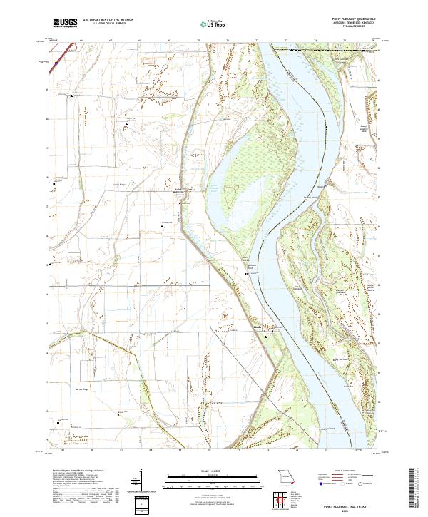
2021 Map of Point Pleasant
USGS Topo · Published 2021About this map
Point Pleasant sits along the western bank of a sharp Mississippi River bend, anchoring a landscape shaped by the river's historical shifts and the complex intersection of Missouri, Tennessee, and Kentucky state lines. This riverine environment is defined by dynamic features like Toneys Chute, Pecan Chute, and Nolan Bar, illustrating the constant movement of silt and water in the Bootheel region. The map reveals a high density of rural burial sites, including the poetically named Lily of the Valley Cem and family-linked sites such as Le Sieur Cem and Girvin Cem, which are vital for genealogical research in this part of New Madrid County.
Find a feature on this map
68 named features on this map. Tap any name to fly to it.
Don’t see what you’re looking for? This feature index may not catch every label — zoom into the map to look around manually.
Map Details
Editions of this 2021 Point Pleasant Map
This is the sole edition of this map. No revisions or reprints were ever made.
Other maps of this area

1925 · Reelfoot Lake
USGS Topo · 1:62,500

1939 · Reelfoot Lake
USGS Topo · 1:62,500

1939 · Portageville
USGS Topo · 1:62,500

1939 · New Madrid
USGS Topo · 1:62,500

1939 · Bayouville
USGS Topo · 1:62,500

1951 · New Madrid SE
USGS Topo · 1:24,000

1951 · Hubbard Lake
USGS Topo · 1:24,000

1954 · New Madrid
USGS Topo · 1:62,500

1955 · Portageville
USGS Topo · 1:62,500

1955 · Bayouville
USGS Topo · 1:62,500