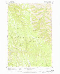
1963 Map of Poison Point
USGS Topo · Published 1978About this map
The high ridges and deep canyons of the Wallowa National Forest define this 1963 survey, a landscape marked by a vital network of isolated water sources and pack trails. Named features like Fairchild Point and Poison Point anchor the higher elevations, while a significant density of named springs—including Poison Spring, Bear Paw Spring, and Box Spring—reveals the importance of seasonal water for forest management and local ranching.
Find a feature on this map
42 named features on this map. Tap any name to fly to it.
Don’t see what you’re looking for? This feature index may not catch every label — zoom into the map to look around manually.
Map Details
Editions of this 1963 Poison Point Map
2 editions found
Other maps of this area

1954 · Imnaha
USGS Topo · 1:62,500

1955 · Grangeville
USGS Topo · 1:250,000

1957 · Elk Mountain
USGS Topo · 1:62,500

1959 · Grangeville
USGS Topo · 1:250,000

1963 · Deadhorse Ridge
USGS Topo · 1:24,000

1963 · Jim Creek Butte
USGS Topo · 1:24,000

1963 · Wapshilla Creek
USGS Topo · 1:24,000

1963 · Poison Point
USGS Topo · 1:24,000
1967 · Billy Meadows
USGS Topo · 1:24,000
1967 · Teepee Butte
USGS Topo · 1:24,000