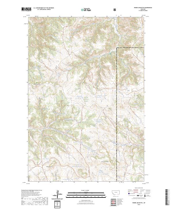
2024 Map of Poker Jim Butte
USGS Topo · Published 2024About this map
Custer National Forest encompasses this high-elevation landscape along the border of Rosebud and Powder River counties. The terrain is defined by dramatic rises like Poker Jim Butte and Wild Hog Butte, which stand as sentinels over a complex network of draws and prongs. Water management is a primary feature of the area, evidenced by the numerous small-scale reservoirs such as Skinny Reservoir, Edith Reservoir, and Horse Cr Basin Reservoir. These features, along with names like the Experimental Pasture Reservoir, suggest a landscape utilized for specialized land management and livestock support within the federal forest boundaries. The region is further intersected by historical pathways and modern trails, including the Brewster Divide Trl and Ridge Road Trl, which follow the natural contours of the O'Dell Divide. Notable spring locations like Jackson Sawmill Spring and Emma Kraft Springs provide glimpses into local heritage and the essential water sources of this high plains environment.
Find a feature on this map
72 named features on this map. Tap any name to fly to it.
Don’t see what you’re looking for? This feature index may not catch every label — zoom into the map to look around manually.
Map Details
Editions of this 2024 Poker Jim Butte Map
This is the sole edition of this map. No revisions or reprints were ever made.
Other maps of this area

1954 · Hardin
USGS Topo · 1:250,000

1957 · Hardin
USGS Topo · 1:250,000

1958 · Hardin
USGS Topo · 1:250,000

1966 · Browns Mountain
USGS Topo · 1:24,000

1966 · Birney Day School
USGS Topo · 1:24,000

1966 · Poker Jim Butte
USGS Topo · 1:24,000

1966 · Fort Howes
USGS Topo · 1:24,000

1966 · King Mountain
USGS Topo · 1:24,000
1966 · Green Creek
USGS Topo · 1:24,000
1972 · Stroud Creek
USGS Topo · 1:24,000