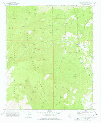
1975 Map of Poland Junction
USGS Topo · Published 1977About this map
Henrietta Mine and the Bannie Mine Dump anchor this detailed study of the industrial landscape within the Prescott National Forest. In the mid-1970s, the region around Poland Junction and Walker remained heavily defined by its mining heritage, evidenced by the numerous excavations and specialized infrastructure like the Poland-Walker Tunnel. The terrain is marked by sharp elevation changes from Big Bug Mesa down into the drainages of Big Bug Creek and Lynx Creek.
Find a feature on this map
82 named features on this map. Tap any name to fly to it.
Don’t see what you’re looking for? This feature index may not catch every label — zoom into the map to look around manually.
Map Details
Editions of this 1975 Poland Junction Map
4 editions found
Other maps of this area

1887 · Prescott
USGS Topo · 1:250,000

1892 · Prescott
USGS Topo · 1:250,000

1903 · Bradshaw Mountains
USGS Topo · 1:125,000

1905 · Jerome
USGS Topo · 1:125,000

1944 · Mingus Mountain
USGS Topo · 1:62,500

1947 · Mingus Mtn
USGS Topo · 1:62,500

1947 · Mayer
USGS Topo · 1:62,500

1947 · Mt. Union
USGS Topo · 1:62,500

1947 · Prescott
USGS Topo · 1:62,500

1948 · Mt. Union
USGS Topo · 1:63,360