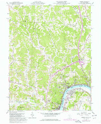
1960 Map of Pomeroy
USGS Topo · Published 1976About this map
Pomeroy and its neighboring river towns serve as the industrial and commercial anchor for this stretch of the Ohio River during the mid-20th century. The landscape is a complex mix of river-level urban development and upland extraction, where extensive Strip Mines and Tipple Mines dominate the ridges behind the settlements. The transportation infrastructure is particularly dense, featuring three major rail lines including the Penn Central, Baltimore and Ohio, and Chesapeake and Ohio, which serviced the coal and manufacturing interests of Middleport, Mason, and Hartford.
Find a feature on this map
84 named features on this map. Tap any name to fly to it.
Don’t see what you’re looking for? This feature index may not catch every label — zoom into the map to look around manually.
Map Details
Editions of this 1960 Pomeroy Map
4 editions found
Other maps of this area

1907 · Pomeroy
USGS Topo · 1:62,500

1907 · Keno
USGS Topo · 1:62,500

1908 · Ravenswood
USGS Topo · 1:62,500

1908 · Point Pleasant
USGS Topo · 1:62,500

1926 · Ravenswood
USGS Topo · 1:62,500

1926 · Point Pleasant
USGS Topo · 1:62,500

1928 · Ravenswood
USGS Topo · 1:62,500

1929 · Point Pleasant
USGS Topo · 1:62,500

1947 · Columbus
USGS Topo · 1:250,000

1949 · Clarksburg
USGS Topo · 1:250,000