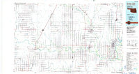
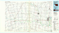
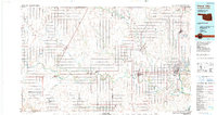
1985 Map of Ponca City
USGS Topo · Published 1985About this map
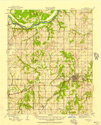
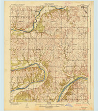
Ponca City and its industrial surroundings define this mid-1980s landscape at the northern edge of Oklahoma. The map documents a territory heavily influenced by petroleum and transportation, shown through extensive Oil and Gas Fields and the converging tracks of the Atchison Topeka and Santa Fe and Chicago Rock Island and Pacific railroads. The wandering paths of the Arkansas River and the Salt Fork Arkansas River cut across the plains, creating distinctive terrain such as Whitworth Bend. Cultural and educational landmarks are prominent, including Northern Oklahoma Junior College in Tonkawa and the northern settlement of Newkirk. From the smaller village of Old Bliss to the hub at Blackwell, the map provides a clear picture of the region's mid-century development and rural-to-urban transition.
Find a feature on this map
99 named features on this map. Tap any name to fly to it.
Don’t see what you’re looking for? This feature index may not catch every label — zoom into the map to look around manually.
Map Details
Editions of this 1985 Ponca City Map
3 editions found
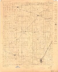
Other maps of this area

1889 · Burden
USGS Topo · 1:125,000

1889 · Anthony
USGS Topo · 1:125,000

1889 · Caldwell
USGS Topo · 1:125,000

1890 · Wellington
USGS Topo · 1:125,000

1891 · Anthony
USGS Topo · 1:125,000

1893 · Caldwell
USGS Topo · 1:125,000
1897 · Caldwell
USGS Topo · 1:125,000
1930 · Pawnee
USGS Topo · 1:62,500

1935 · Kaw
USGS Topo · 1:62,500
1936 · Belford
USGS Topo · 1:62,500