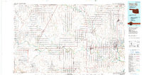
1985 Map of Ponca City
USGS Topo · Published 1990About this map
The Salt Fork Arkansas River and the main stem of the Arkansas River converge in this Northern Oklahoma landscape during the mid-1980s. A network of heavy rail lines, including the Atchison Topeka and Santa Fe and the Chicago Rock Island and Pacific, connects agricultural hubs like Medford, Blackwell, and Tonkawa. The eastern edge of the map is dominated by the waters of Kaw Lake and the Kaw Indian Reservation, highlighting the region's complex history of tribal land and modern water management.
Find a feature on this map
70 named features on this map. Tap any name to fly to it.
Don’t see what you’re looking for? This feature index may not catch every label — zoom into the map to look around manually.
Map Details
Editions of this 1985 Ponca City Map
3 editions found
Other maps of this area

1889 · Burden
USGS Topo · 1:125,000

1889 · Anthony
USGS Topo · 1:125,000

1889 · Caldwell
USGS Topo · 1:125,000

1890 · Wellington
USGS Topo · 1:125,000

1891 · Anthony
USGS Topo · 1:125,000

1893 · Caldwell
USGS Topo · 1:125,000

1897 · Caldwell
USGS Topo · 1:125,000

1930 · Pawnee
USGS Topo · 1:62,500

1935 · Kaw
USGS Topo · 1:62,500

1936 · Belford
USGS Topo · 1:62,500