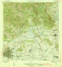
1945 Map of Ponce
USGS Topo · Published 1945About this map
Agricultural haciendas and organized poblaciones define the mid-century landscape of southern Puerto Rico, illustrating a transition between traditional plantation life and industrial development. Large estates such as Hacienda Margarita and Hacienda Monserrate are prominent landmarks alongside the extensive Central Mercedita sugar mill complex. The map reveals an intricate hydrological network vital to this economy, featuring Lago Guayabal and a series of numbered reservoirs like Lago No 5, which fed the coastal plains. Development centers around Juana Díaz and the outskirts of Ponce, where transport infrastructure like the Linea de Transmision and Carretera 1 connect the inland mountain foothills to the coast. Cultural and administrative life is marked by numerous small settlements, including Poblado Collores and Poblado Jacaguas, and a significant Military Reservation situated near the southeastern boundary.
Find a feature on this map
85 named features on this map. Tap any name to fly to it.
Don’t see what you’re looking for? This feature index may not catch every label — zoom into the map to look around manually.
Map Details
Editions of this 1945 Ponce Map
3 editions found
Other maps of this area

1944 · Santa Isabel
USGS Topo · 1:30,000

1945 · Playa De Ponce
USGS Topo · 1:30,000

1945 · Ponce
USGS Topo · 1:30,000

1945 · Rio Descalabrado
USGS Topo · 1:30,000

1946 · Punta Cuchara
USGS Topo · 1:30,000

1946 · Jayuya
USGS Topo · 1:30,000

1946 · Orocovis
USGS Topo · 1:30,000

1946 · Penuelas
USGS Topo · 1:30,000

1946 · Adjuntas
USGS Topo · 1:30,000

1947 · Ponce NE
USGS Topo · 1:10,000