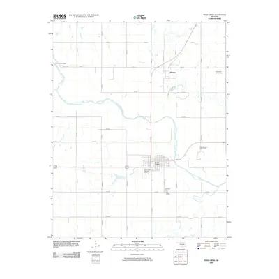
2009 Map of Pond Creek
USGS Topo · Published 2009About this map
The Salt Fork Arkansas River meanders across this Grant County landscape, defining the geography of an area dominated by agricultural grid-lines and energy production. The town of Pond Creek serves as a central hub at the intersection of major transit routes, where the Pond Creek Municipal Airport and a traditional street grid suggest a well-established plains community. Just to the north, the smaller settlement of Jefferson sits near Osage Creek, illustrating the characteristic spacing of towns along early transportation corridors.
Find a feature on this map
31 named features on this map. Tap any name to fly to it.
Don’t see what you’re looking for? This feature index may not catch every label — zoom into the map to look around manually.
Map Details
Editions of this 2009 Pond Creek Map
This is the sole edition of this map. No revisions or reprints were ever made.
Other maps of this area

1955 · Enid
USGS Topo · 1:250,000

1958 · Enid
USGS Topo · 1:250,000

1968 · Hillsdale
USGS Topo · 1:24,000

1968 · Lamont NW
USGS Topo · 1:24,000

1968 · Hunter
USGS Topo · 1:24,000

1968 · Wakita SE
USGS Topo · 1:24,000

1968 · Kremlin
USGS Topo · 1:24,000

1968 · Medford
USGS Topo · 1:24,000

1968 · Pond Creek
USGS Topo · 1:24,000

1968 · Pond Creek NW
USGS Topo · 1:24,000