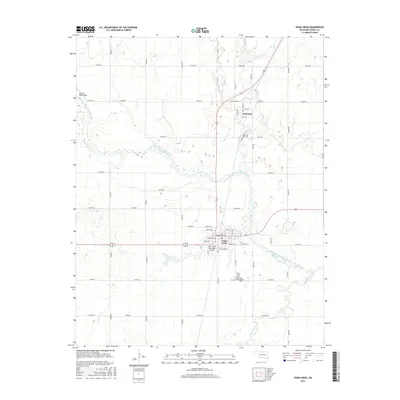
2016 Map of Pond Creek
USGS Topo · Published 2016About this map
The Salt Fork Arkansas River carves a winding path through the heart of Grant County, anchoring the landscape of Pond Creek and Jefferson. This northern Oklahoma region is defined by a grid of rural sections where tributaries like Osage Cr and Wild Horse Creek flow toward the primary river channel. The settlement pattern shows two distinct hubs: Jefferson to the north near the river bend, and the larger center of Pond Creek to the south. Local history is deeply rooted in the land, as evidenced by several established burial grounds including Jefferson Park Cem, Pond Creek Cem, and Saint Josephs Cem. Transportation is dominated by the intersection of major roadways and the Pond Creek Municipal Airport, while the Red Hill Road Bridge provides a critical crossing over the river's braided channel in the northwest corner.
Find a feature on this map
46 named features on this map. Tap any name to fly to it.
Don’t see what you’re looking for? This feature index may not catch every label — zoom into the map to look around manually.
Map Details
Editions of this 2016 Pond Creek Map
This is the sole edition of this map. No revisions or reprints were ever made.
Other maps of this area

1955 · Enid
USGS Topo · 1:250,000

1958 · Enid
USGS Topo · 1:250,000

1968 · Hillsdale
USGS Topo · 1:24,000

1968 · Lamont NW
USGS Topo · 1:24,000

1968 · Hunter
USGS Topo · 1:24,000

1968 · Wakita SE
USGS Topo · 1:24,000

1968 · Kremlin
USGS Topo · 1:24,000

1968 · Medford
USGS Topo · 1:24,000

1968 · Pond Creek
USGS Topo · 1:24,000

1968 · Pond Creek NW
USGS Topo · 1:24,000