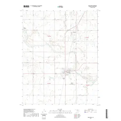
2018 Map of Pond Creek
USGS Topo · Published 2018About this map
Pond Creek serves as a primary hub in this portion of Grant County, situated at the intersection of several local routes south of the Salt Fork Arkansas River. The landscape is defined by the drainage patterns of Wild Horse Creek, Osage Cr, and Pond Cr, which carve through the Oklahoma plains. North of the river, the smaller settlement of Jefferson is centered near the junction of Old US Hwy 81 and Main St. Local history and genealogy interest is concentrated at three distinct sites: Jefferson Park Cem to the north, and both the Pond Creek Cem and Saint Josephs Cem located south of town near the Pond Creek Municipal Airport. The Red Hill Road Bridge provides a specific crossing point in the northwest, highlighting the area's reliance on river access and surveyed section roads.
Find a feature on this map
56 named features on this map. Tap any name to fly to it.
Don’t see what you’re looking for? This feature index may not catch every label — zoom into the map to look around manually.
Map Details
Editions of this 2018 Pond Creek Map
This is the sole edition of this map. No revisions or reprints were ever made.
Other maps of this area

1955 · Enid
USGS Topo · 1:250,000

1958 · Enid
USGS Topo · 1:250,000

1968 · Hillsdale
USGS Topo · 1:24,000

1968 · Lamont NW
USGS Topo · 1:24,000

1968 · Hunter
USGS Topo · 1:24,000

1968 · Wakita SE
USGS Topo · 1:24,000

1968 · Kremlin
USGS Topo · 1:24,000

1968 · Medford
USGS Topo · 1:24,000

1968 · Pond Creek
USGS Topo · 1:24,000

1968 · Pond Creek NW
USGS Topo · 1:24,000