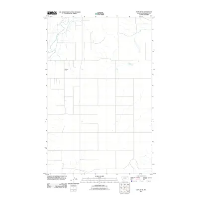
2011 Map of Poplar NE
USGS Topo · Published 2011About this map
The East Poplar Oil Field defines much of the industrial character of this northeastern Montana landscape, where the extraction economy meets the drainage systems of the Missouri River watershed. The terrain is marked by a grid-like network of rural routes, including Fas 251, which provide access to the oil infrastructure and scattered agricultural interests in this corner of Roosevelt County. Natural water features create the primary breaks in the human-imposed grid, with the Poplar River winding through the western portion and Lake Creek cutting across the northeastern section. This survey documents the intersection of natural hydrology and modern energy production in the Brockton District, showing how the land was partitioned and utilized for resource extraction in the early 21st century.
Find a feature on this map
4 named features on this map. Tap any name to fly to it.
Don’t see what you’re looking for? This feature index may not catch every label — zoom into the map to look around manually.
Map Details
Editions of this 2011 Poplar NE Map
This is the sole edition of this map. No revisions or reprints were ever made.
Other maps of this area

1909 · Smoke Creek
USGS Topo · 1:62,500

1912 · Hay Creek
USGS Topo · 1:62,500

1912 · Poplar
USGS Topo · 1:62,500

1912 · Smoke Creek
USGS Topo · 1:62,500

1914 · Brockton
USGS Topo · 1:62,500

1954 · Wolf Point
USGS Topo · 1:250,000

1958 · Wolf Point
USGS Topo · 1:250,000

1972 · Poplar
USGS Topo · 1:24,000

1972 · Poplar NE
USGS Topo · 1:24,000
1972 · Mortarstone Bluff
USGS Topo · 1:24,000