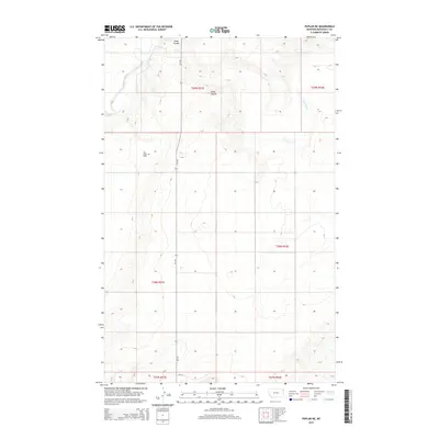
2014 Map of Poplar NE
USGS Topo · Published 2014About this map
The East Poplar Oil Field defines much of the industrial character of this northeastern Montana landscape, located north of the Missouri River valley. The terrain is marked by significant topographical relief, where the Poplar River winds through the western reaches and Lake Creek cuts across the northeastern corner. This 2014 survey reveals a sparse settlement pattern dominated by the energy sector and agricultural land divisions. A network of local roads, including MT-251 and Bia-35, provides the primary access through the sections of Roosevelt County. The presence of Slims Coulee and various unnamed drainages highlights the erosional nature of the high plains, showing the intersection of natural waterways with modern resource extraction.
Find a feature on this map
13 named features on this map. Tap any name to fly to it.
Don’t see what you’re looking for? This feature index may not catch every label — zoom into the map to look around manually.
Map Details
Editions of this 2014 Poplar NE Map
This is the sole edition of this map. No revisions or reprints were ever made.
Other maps of this area

1909 · Smoke Creek
USGS Topo · 1:62,500

1912 · Hay Creek
USGS Topo · 1:62,500

1912 · Poplar
USGS Topo · 1:62,500

1912 · Smoke Creek
USGS Topo · 1:62,500

1914 · Brockton
USGS Topo · 1:62,500

1954 · Wolf Point
USGS Topo · 1:250,000

1958 · Wolf Point
USGS Topo · 1:250,000

1972 · Poplar
USGS Topo · 1:24,000

1972 · Poplar NE
USGS Topo · 1:24,000
1972 · Mortarstone Bluff
USGS Topo · 1:24,000