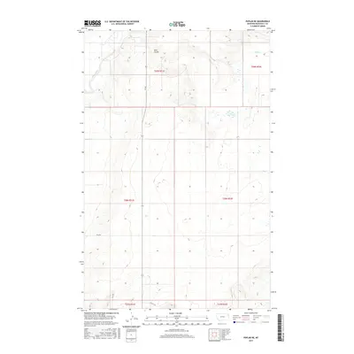
2017 Map of Poplar NE
USGS Topo · Published 2017About this map
Poplar River winds through the western reaches of this Roosevelt County landscape, defining the local drainage patterns alongside Slims Coulee and Lake Cr. The area is characterized by a high-plains topography organized by a rigorous township and range grid, including t29n r51e and t28n r52e. This 2017 survey reflects a contemporary view of the Brockton District, where local infrastructure is represented by routes like Bia Rte 140 and Ry Rd. Small wetlands and seasonal water features dot the terrain, illustrating the hydrologic character of the Montana prairie. The map provides a precise record of section lines and rural access roads such as Rd 2058 and Rd 1049, which are essential for tracing land ownership and ranching boundaries in this part of the state.
Find a feature on this map
13 named features on this map. Tap any name to fly to it.
Don’t see what you’re looking for? This feature index may not catch every label — zoom into the map to look around manually.
Map Details
Editions of this 2017 Poplar NE Map
This is the sole edition of this map. No revisions or reprints were ever made.
Other maps of this area

1909 · Smoke Creek
USGS Topo · 1:62,500

1912 · Hay Creek
USGS Topo · 1:62,500

1912 · Poplar
USGS Topo · 1:62,500

1912 · Smoke Creek
USGS Topo · 1:62,500

1914 · Brockton
USGS Topo · 1:62,500

1954 · Wolf Point
USGS Topo · 1:250,000

1958 · Wolf Point
USGS Topo · 1:250,000

1972 · Poplar
USGS Topo · 1:24,000

1972 · Poplar NE
USGS Topo · 1:24,000
1972 · Mortarstone Bluff
USGS Topo · 1:24,000