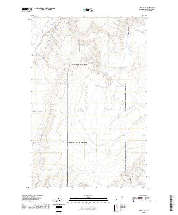
2024 Map of Poplar NE
USGS Topo · Published 2024About this map
The Poplar River winds through the northwestern corner of this landscape, defining the topography of this part of Roosevelt County. The terrain is characterized by a network of drainages and seasonal watercourses, most notably Slims Coulee and Lake Creek, which cut across the high plains. The map illustrates a sparse, rural infrastructure typical of the northern Montana borderlands, where movement is dictated by a few critical corridors such as Bia Rte 140 and Ry Rd. These survey lines and local routes, including Rd 1049 and Rd 2058, provide the primary access to the vast agricultural and ranching sections that comprise the majority of the quadrangle. The grid of the Public Land Survey System is clearly visible, showing the organization of the land into townships such as T29N R51E and T29N R52E.
Find a feature on this map
11 named features on this map. Tap any name to fly to it.
Don’t see what you’re looking for? This feature index may not catch every label — zoom into the map to look around manually.
Map Details
Editions of this 2024 Poplar NE Map
This is the sole edition of this map. No revisions or reprints were ever made.
Other maps of this area

1909 · Smoke Creek
USGS Topo · 1:62,500

1912 · Hay Creek
USGS Topo · 1:62,500

1912 · Poplar
USGS Topo · 1:62,500

1912 · Smoke Creek
USGS Topo · 1:62,500

1914 · Brockton
USGS Topo · 1:62,500

1954 · Wolf Point
USGS Topo · 1:250,000

1958 · Wolf Point
USGS Topo · 1:250,000

1972 · Poplar
USGS Topo · 1:24,000

1972 · Poplar NE
USGS Topo · 1:24,000
1972 · Mortarstone Bluff
USGS Topo · 1:24,000