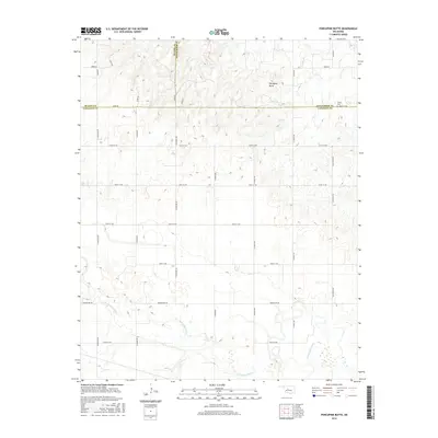
2016 Map of Porcupine Butte
USGS Topo · Published 2016About this map
The N Canadian River meanders across the southern landscape of this 2016 survey, defining the topography of Canadian County. To the north, the elevation rises toward Porcupine Butte, a prominent geographic landmark situated near the borders of Blaine and Kingfisher Counties. This region is characterized by a dense grid of rural corridors, including N Walbaum Rd and N Mayberry Rd, which segment the agricultural land and connect isolated homesteads to larger county thoroughfares. Genealogists and local historians will find the Salem Cem in the northeastern corner of the map, a quiet site established near the intersection of 248th St NW and N2730 Rd. The map also reveals the presence of a small Lake tucked into the hills south of the butte, illustrating the local water management patterns in this portion of the Oklahoma plains.
Find a feature on this map
30 named features on this map. Tap any name to fly to it.
Don’t see what you’re looking for? This feature index may not catch every label — zoom into the map to look around manually.
Map Details
Editions of this 2016 Porcupine Butte Map
This is the sole edition of this map. No revisions or reprints were ever made.
Other maps of this area

1893 · Fort Reno
USGS Topo · 1:62,500

1893 · Loyal
USGS Topo · 1:62,500

1941 · Fort Reno
USGS Topo · 1:62,500

1942 · Fort Reno
USGS Topo · 1:62,500

1942 · Geary
USGS Topo · 1:62,500

1949 · Fort Reno
USGS Topo · 1:62,500

1955 · Clinton
USGS Topo · 1:250,000

1957 · Clinton
USGS Topo · 1:250,000

1967 · Fort Reno SW
USGS Topo · 1:24,000
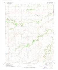
1972 · Loyal SE
USGS Topo · 1:24,000