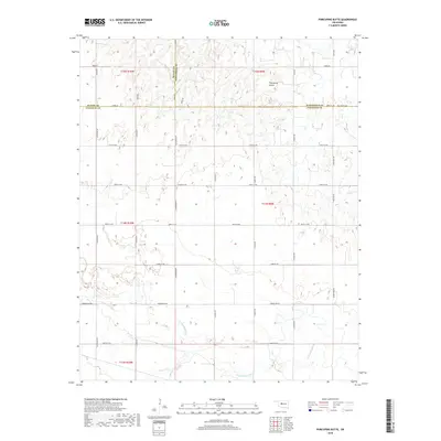
2018 Map of Porcupine Butte
USGS Topo · Published 2018About this map
Porcupine Butte rises as a prominent landmark in this corner of the Oklahoma prairie, where the boundaries of Canadian, Kingfisher, and Blaine counties converge. The southern portion of the landscape is defined by the winding course of the N Canadian River, which creates a complex network of wetlands and shifting channels. This area preserves a traditional section-line road grid, with thoroughfares like Edmond Rd NW and N Walbaum Rd providing access to the agricultural parcels that dominate the terrain. Genealogists may find particular interest in the location of Salem Cem in the northeast, a quiet site established near the intersection of 248th St NW and N Red Rock Rd. The map illustrates the sparsely populated nature of the region in the late 2010s, showing a landscape still primarily dedicated to farming and ranching away from major urban centers.
Find a feature on this map
28 named features on this map. Tap any name to fly to it.
Don’t see what you’re looking for? This feature index may not catch every label — zoom into the map to look around manually.
Map Details
Editions of this 2018 Porcupine Butte Map
This is the sole edition of this map. No revisions or reprints were ever made.
Other maps of this area

1893 · Fort Reno
USGS Topo · 1:62,500

1893 · Loyal
USGS Topo · 1:62,500

1941 · Fort Reno
USGS Topo · 1:62,500

1942 · Fort Reno
USGS Topo · 1:62,500

1942 · Geary
USGS Topo · 1:62,500

1949 · Fort Reno
USGS Topo · 1:62,500

1955 · Clinton
USGS Topo · 1:250,000

1957 · Clinton
USGS Topo · 1:250,000

1967 · Fort Reno SW
USGS Topo · 1:24,000
1972 · Loyal SE
USGS Topo · 1:24,000