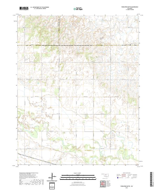
2022 Map of Porcupine Butte
USGS Topo · Published 2022About this map
Porcupine Butte rises as a prominent landmark in this Oklahoma landscape where the borders of Blaine, Kingfisher, and Canadian counties meet. The southern portion of the area is defined by the winding course of the N Canadian River, which creates a complex pattern of wetlands and low-lying terrain across the section lines. This modern survey illustrates a strictly organized rural grid system, with roads like Edmond Rd NW and N Walbaum RD providing access to isolated homesteads and agricultural plots. Near the intersection of the county lines, the Salem Cem stands as a quiet focal point for local genealogical research, marking the location of an early community cemetery. The landscape transitions from the river valley to the higher ground surrounding the butte, maintaining the section-and-range structure established by the original land surveys.
Find a feature on this map
28 named features on this map. Tap any name to fly to it.
Don’t see what you’re looking for? This feature index may not catch every label — zoom into the map to look around manually.
Map Details
Editions of this 2022 Porcupine Butte Map
This is the sole edition of this map. No revisions or reprints were ever made.
Other maps of this area

1893 · Fort Reno
USGS Topo · 1:62,500

1893 · Loyal
USGS Topo · 1:62,500

1941 · Fort Reno
USGS Topo · 1:62,500

1942 · Fort Reno
USGS Topo · 1:62,500

1942 · Geary
USGS Topo · 1:62,500

1949 · Fort Reno
USGS Topo · 1:62,500

1955 · Clinton
USGS Topo · 1:250,000

1957 · Clinton
USGS Topo · 1:250,000

1967 · Fort Reno SW
USGS Topo · 1:24,000
1972 · Loyal SE
USGS Topo · 1:24,000