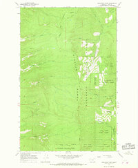
1965 Map of Porcupine Creek
USGS Topo · Published 1968About this map
The Mission Range and Flathead Range define this high-altitude landscape in western Montana, where the boundary of the Flathead Indian Reservation meets extensive public timberlands. Surveyed in the mid-1960s, the map reveals a wilderness primarily managed as the Flathead National Forest and the Swan River State Forest. The drainage patterns are intricate, with numerous westward-flowing streams such as Blue Bay Creek, Teepee Creek, and Talking Water Creek cutting through the steep slopes.
Find a feature on this map
21 named features on this map. Tap any name to fly to it.
Don’t see what you’re looking for? This feature index may not catch every label — zoom into the map to look around manually.
Map Details
Editions of this 1965 Porcupine Creek Map
2 editions found
Other maps of this area

1920 · Flathead Lake
USGS Topo · 1:125,000

1955 · Choteau
USGS Topo · 1:250,000

1956 · Wallace
USGS Topo · 1:250,000

1957 · Choteau
USGS Topo · 1:250,000

1958 · Choteau
USGS Topo · 1:250,000

1960 · Wallace
USGS Topo · 1:250,000

1962 · Choteau
USGS Topo · 1:250,000

1964 · Bull Island
USGS Topo · 1:24,000

1964 · East Bay
USGS Topo · 1:24,000
1964 · Woods Bay
USGS Topo · 1:24,000