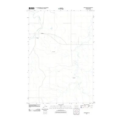
2011 Map of Porcupine
USGS Topo · Published 2011About this map
The Cannonball River winds through the northwest corner of this Sioux County landscape, where the prairie gives way to the prominent elevation of Piuss Butte. Centered around the community of Porcupine, the map documents a region defined by its watercourses and rural transit routes like BIA Route 7. A sense of local history is preserved at the Congregational Cemetery located just west of the main settlement. To the east and south, the meandering path of Porcupine Creek dictates the topography, flowing past the small locality of Chadwick. This 2011 survey captures the distribution of remote farmsteads and the spatial relationship between the river valley and the higher butte country within the Porcupine District.
Find a feature on this map
7 named features on this map. Tap any name to fly to it.
Don’t see what you’re looking for? This feature index may not catch every label — zoom into the map to look around manually.
Map Details
Editions of this 2011 Porcupine Map
This is the sole edition of this map. No revisions or reprints were ever made.
Other maps of this area

1954 · Bismarck
USGS Topo · 1:250,000

1958 · Bismarck
USGS Topo · 1:250,000

1971 · Shields SW
USGS Topo · 1:24,000

1971 · Froelich Dam
USGS Topo · 1:24,000

1971 · Shields
USGS Topo · 1:24,000

1971 · Solen SW
USGS Topo · 1:24,000

1971 · Porcupine
USGS Topo · 1:24,000

1971 · Timmer
USGS Topo · 1:24,000

1971 · Selfridge
USGS Topo · 1:24,000

1971 · Pamplin Hills
USGS Topo · 1:24,000