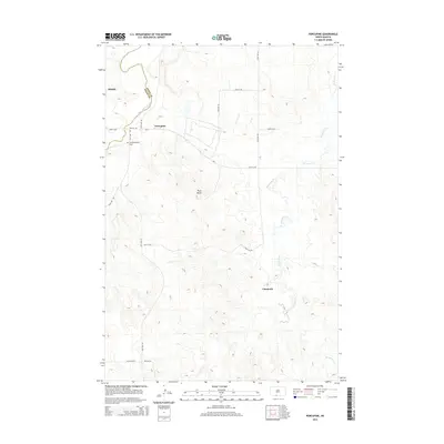
2014 Map of Porcupine
USGS Topo · Published 2014About this map
The Cannonball River winds through the northern reaches of this Sioux County landscape, defining the border between Sioux and Grant counties near the settlement of Shields. This 2014 survey documents the open prairie of the Porcupine District, where the terrain is punctuated by significant natural landmarks like Piuss Butte. The area is marked by a grid of rural roads and the prominent Bia-7 route, which serves as a primary artery connecting the various small communities and ranchlands.
Find a feature on this map
15 named features on this map. Tap any name to fly to it.
Don’t see what you’re looking for? This feature index may not catch every label — zoom into the map to look around manually.
Map Details
Editions of this 2014 Porcupine Map
This is the sole edition of this map. No revisions or reprints were ever made.
Other maps of this area

1954 · Bismarck
USGS Topo · 1:250,000

1958 · Bismarck
USGS Topo · 1:250,000

1971 · Shields SW
USGS Topo · 1:24,000

1971 · Froelich Dam
USGS Topo · 1:24,000

1971 · Shields
USGS Topo · 1:24,000

1971 · Solen SW
USGS Topo · 1:24,000

1971 · Porcupine
USGS Topo · 1:24,000

1971 · Timmer
USGS Topo · 1:24,000

1971 · Selfridge
USGS Topo · 1:24,000

1971 · Pamplin Hills
USGS Topo · 1:24,000