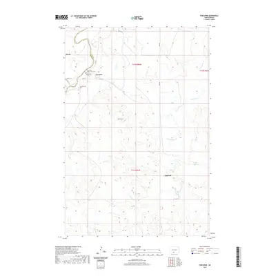
2020 Map of Porcupine
USGS Topo · Published 2020About this map
The Cannonball River meanders across the northwestern corner of this Sioux County landscape, marking a topographic transition near the small settlement of Shields. Just to the east, the community of Porcupine serves as a local hub, characterized by religious and commemorative sites including Saint James Catholic Church and its associated Saint James Catholic Church Cem, alongside the Congregational Cem.
Find a feature on this map
20 named features on this map. Tap any name to fly to it.
Don’t see what you’re looking for? This feature index may not catch every label — zoom into the map to look around manually.
Map Details
Editions of this 2020 Porcupine Map
This is the sole edition of this map. No revisions or reprints were ever made.
Other maps of this area

1954 · Bismarck
USGS Topo · 1:250,000

1958 · Bismarck
USGS Topo · 1:250,000

1971 · Shields SW
USGS Topo · 1:24,000

1971 · Froelich Dam
USGS Topo · 1:24,000

1971 · Shields
USGS Topo · 1:24,000

1971 · Solen SW
USGS Topo · 1:24,000

1971 · Porcupine
USGS Topo · 1:24,000

1971 · Timmer
USGS Topo · 1:24,000

1971 · Selfridge
USGS Topo · 1:24,000

1971 · Pamplin Hills
USGS Topo · 1:24,000